
Tracing the old Boundary of North Georgia
After the 1790 Treaty of New York, a series of blockhouses and Forts were built in North Georgia along the Cherokee and Creek lines. The Wofford or 4 mile purchase was a result of two of these forts and their settlements being constructed on the wrong side of the line. After the Red Stick Creek defeat, one of the concessions made by the Creeks was done at Fort Strother (now in Alabama) on January 22nd 1816. Of note to me the the location of the High Falls of the Apalachee river, the “Shallowford” on the Chattahoochee, the Hightower trail, and the most interesting a dotted line from Oghechee River to the Tugaloo river. There is a historical marker on the Georgia side of the Tugaloo river that marks this line’s terminus.
#georgiahistory #georgiarivers #creek #Cherokee

1816 Map of Creek Lands
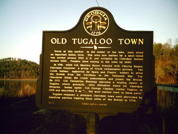
Old Tugaloo Town Marker outside Toccoa, GA

1804 Survey document marking the 1790 Treaty of New York as it applied in North Georgia