The Bostwick Railroad began as a feeder line to connect the town of Bostwick to the Central of Georgia line in the town of Apalachee. Eventuallt the line was bought out around 1914 as was operated at the Greene County Railroad until 1942 when it was oficially abandoned. The Greene County Railroad expanded the line from Bostwick to Monroe connecting the the mills there. Below are some links and info about the railroad I hope you find useful.
The National Archives in College Park, MD has the detailed Val maps for the Greene County Railroad. There are 10 maps in total, but they are not digitized or available online. If you are in the DC area you can go and see or make copies of them. Below is the link to the file details.

This 1931 Georgia State Highway map is available at the Georgia State Archives. The Greene County Railroad is noted where is departs from the Central of Georgia at Apalachee and travels to Monroe via Bostwick and Good Hope.

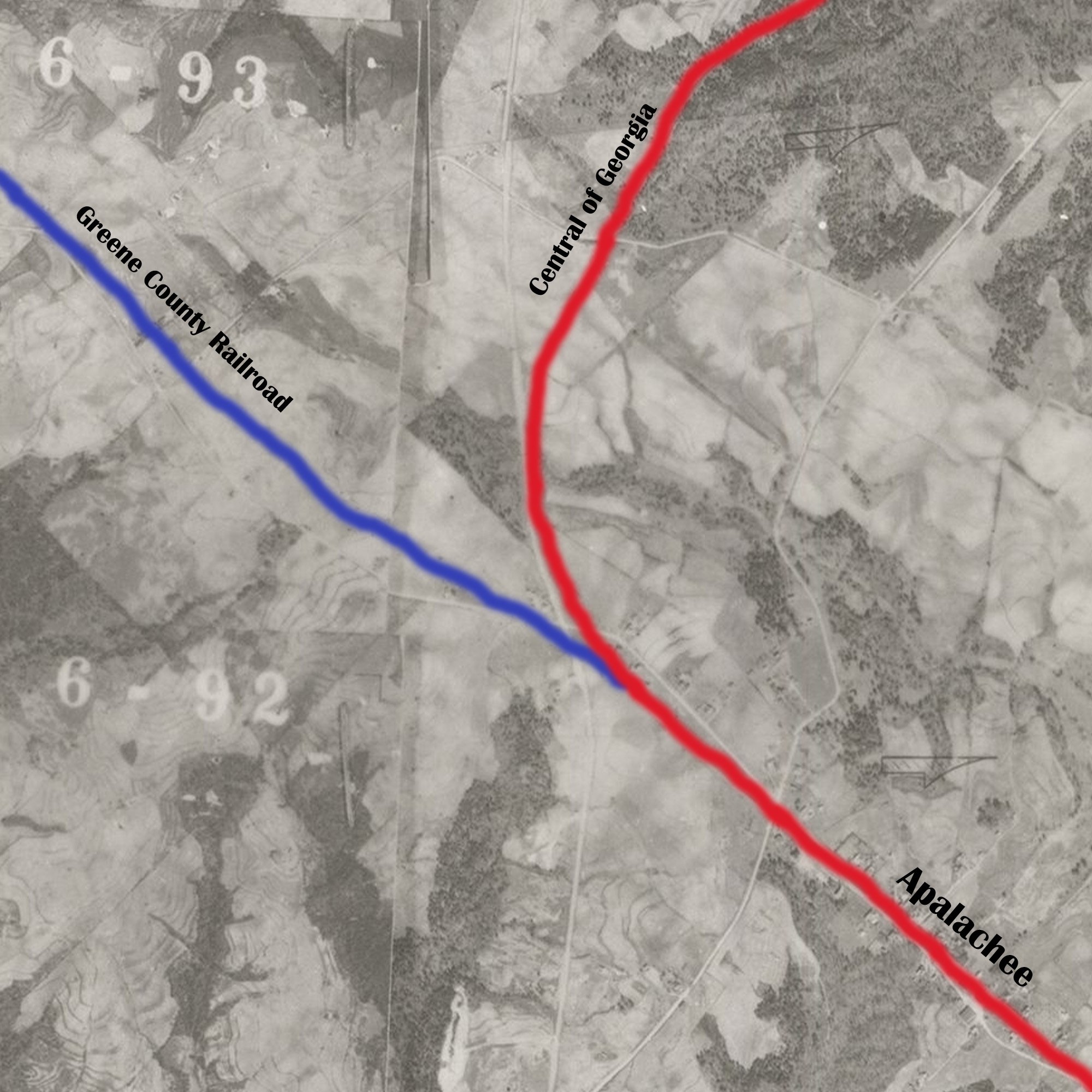
A modern map here is layered on top of the 1931 map with the COG and the CGRR color coded.

1930 Map of Walton County mail delivery routes. The Greene County Railroad can be seen entering the county and then making a turn at Good Hope enroute to termination at Monroe.

1930 Walton Map with Greene County Railroad in Blue and Monroe Railroad in Red and Gainesville Midland in Red. The location known as Cowpens on this map is near the airport and the gas station has a sign that says “Welcome to Cowpens”.
The State of Georgia required all railroads operating within the state to submit a yearly report to the State Railroad Commission. These reports are mostly focoused on the financial details, but can provide insight into the area. As i get the reports for the Greene County Railroad digitized I will upload them below.
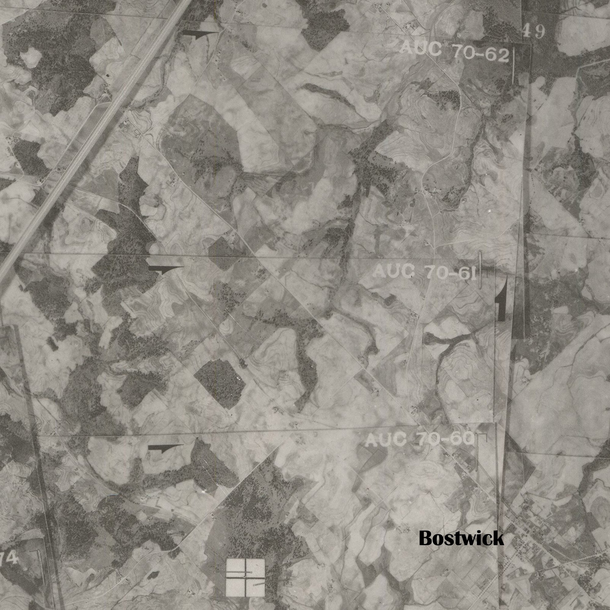
Below images are from the 1939 USDA overhead farm shots.